Using explainable machine learning to understand how urban form shapes sustainable mobility

Abstract
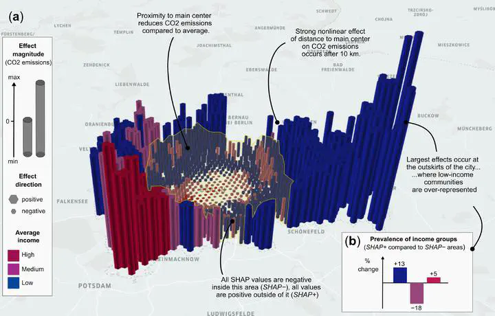
Municipalities are increasingly acknowledging the importance of urban form interventions that can reduce intra-city car travel in achieving more sustainable cities. Current academic knowledge for supporting such policies falls short in providing the spatial details required to plan specific interventions. Here, we develop an explainable machine learning framework to identify location-specific relevance of built environment for urban motorised travel, using a sample of 3.5 million car commutes over one year in Berlin and high-resolution urban form data. Results demonstrate that subcenters play a vital role in reducing commuting-related travel distance, giving support to the 15-minute city hypothesis. Observed threshold effects of induced CO2 emissions require low-carbon-policies targeted towards densifying the inner city while releasing peripheral low income communities from car dependence. This research provides a starting point for increasingly rich big data analyses of urban form for creating low-carbon and inclusive urban planning strategies.